The top of Fuji is a crater ringed by peaks. Climbers who reach the rim can walk around it in about an hour, a circuit called ohachi-meguri, and the highest point, 3,776 meters, stands beside the weather station on the far side from the Yoshida Trail.
The rim is shrine ground. A detached shrine of Fujisan Hongū Sengen Taisha stands at the summit, and a priest stays there during the July and August climbing season.
Each trail is divided into ten stations, from the first at the foot to the tenth at the summit. Roads end at the fifth stations, and most climbers walk from there.
Huts along the upper trails, more than a dozen of them on the Yoshida Trail alone, give climbers a bed and a meal. Many climbers sleep in one and leave in the night to reach the top by sunrise. The huts open only in the climbing season.
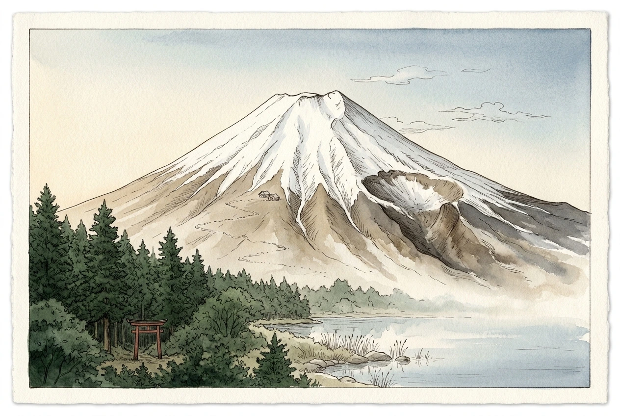
A torii marks the entrance to a shrine’s ground. The Sengen shrines around Fuji were founded to calm the mountain after its eruptions, and they honor Konohanasakuya-hime, the “blossom princess”.
Their head shrine, Fujisan Hongū Sengen Taisha, holds the mountain itself above the eighth station, so a climber who goes beyond it is walking on shrine land.
Five lakes lie along Fuji’s northern foot, held in valleys that lava flows dammed. In 864 an eruption on the northwestern slope sent lava into a large lake called Senoumi and split it, leaving the present lakes Shōji and Sai.
The lakes are listed with the mountain as part of its World Heritage site.
Mount Fuji rises 3,776 meters near the Pacific coast of Honshū, about a hundred kilometers west-southwest of Tokyo. It is the youngest of several volcanoes built on the same spot. The summit of Komitake, active about 700,000 years ago, now lies on Fuji’s northern slope, and an older cone, Ko-Fuji, lies buried beneath the present one, Shin-Fuji.
Records of seventeen eruptions survive from 781 onward. The Fujisan Hongū Sengen Taisha shrine at the southwestern foot of the mountain was built to calm it; its present site dates from 806. The shrine heads more than 1,300 Sengen shrines across Japan, and after his victory at Sekigahara in 1600, Tokugawa Ieyasu declared that all the land above the mountain’s eighth station belonged to it. The shrine still holds the summit.
From Edo, Fuji stood on the western horizon. Katsushika Hokusai’s Thirty-six Views of Mount Fuji, published from about 1830, included the mountain seen above the warehouses of Nihonbashi, and prints of the city’s famous places sold cheaply.
Many people in Edo belonged to Fuji confraternities (Fuji-kō), which traced themselves to the ascetic Hasegawa Kakugyō (1541–1646). At their height there were said to be more than eight hundred of them. Each year they sent some of their members on the summer pilgrimage, and for those who could not go they built small copies of the mountain in the city (fujizuka). The first, finished in 1780 by a group led by Takada Tōshirō, was about ten meters high and faced with volcanic stone carried from Fuji. Like the later mounds, it had stations marked on the way up, so that climbing it stood for climbing the mountain. More than sixty survive in and around Tokyo.
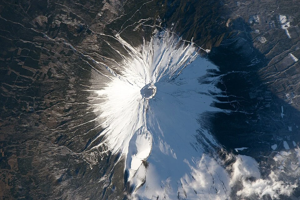
Fuji last erupted on 16 December 1707, forty-nine days after the Hōei earthquake, one of the largest in Japan’s history. The eruption did not come from the summit. New vents opened on the southeastern flank, and the hollow they left, the Hōei crater, can be seen from space.
No lava flowed. Over about two weeks the vents threw out some 0.7 cubic kilometers of magma as pumice and ash, and ash fell on Edo, about a hundred kilometers away, on the first day. Fuji is still classed as an active volcano, and the Japan Meteorological Agency watches it continuously.
Mount Fuji seen from the International Space Station during Expedition 46, with the summit crater at the center and the 1707 Hōei crater below it (NASA, Public Domain via Wikimedia Commons).
The climb is still counted in ten stations, from the first at the foot to the tenth at the summit. Roads reach the fifth stations, between about 1,400 and 2,400 meters up, and most climbers start there.
The trails are open from July to 10 September. Outside the season, climbing above the fifth stations is prohibited, and the huts and first-aid stations are closed. Since 2025 every climber pays a fee of 4,000 yen, the trailheads close from 2 p.m. to 3 a.m. to anyone without a hut booking, and the Yoshida Trail admits at most 4,000 people a day.
UNESCO inscribed Fuji on the World Heritage List in 2013 as a sacred place and a source of artistic inspiration, together with shrines, lakes and other sites around it. In 2024 the snow on its summit, which usually appears in early October, was not seen until 7 November, the latest date since records began in 1894.
A watercolor study that brings together views of Mount Fuji no single viewpoint would show at once: the snow-covered cone, the Hōei crater on its southeastern slope, a climbing trail with huts, a shrine gate in the forest below and a lake at the foot. The story below includes a photograph taken from the International Space Station.